 Daily Ancestor
The Hickory on Four Mile Run
A 1730 Virginia land grant names a tree, a neighbor and a rent day, and each one leads to the next record.
In February 1730, Lord Fairfax's land office in Lancaster County, Virginia, issued a land grant, and a clerk copied it into a big bound book. His best lettering went to the lord who owned the land. The man receiving it got ordinary handwriting: Francis Awbrey, of Stafford County, 1,261 acres on the branches of Four Mile Run. Nearly three hundred years later, those two pages still tell us where Francis's land began (at a hickory tree), what he owed for it every year, and who lived next door. Follow the neighbor, and the story keeps going for almost forty years.
Start with who is giving the land. The grant does not come from the King or the colony. It opens with "The Right Hon[oura]ble Thomas Lord Fairfax" and William Cage of Kent, England, executor of the late Catherine Lady Fairfax, calling themselves the "Proprietors of the Northern Neck of Virginia." Between the Potomac and Rappahannock rivers, land came from this private proprietary, not from the Crown, and its grants were kept in their own books. That is why this record sits at the Library of Virginia as Northern Neck Grants, Book C, pages 30 and 31. If your ancestor held land in that corner of Virginia, this is the series to ask for, not the ordinary land patents.
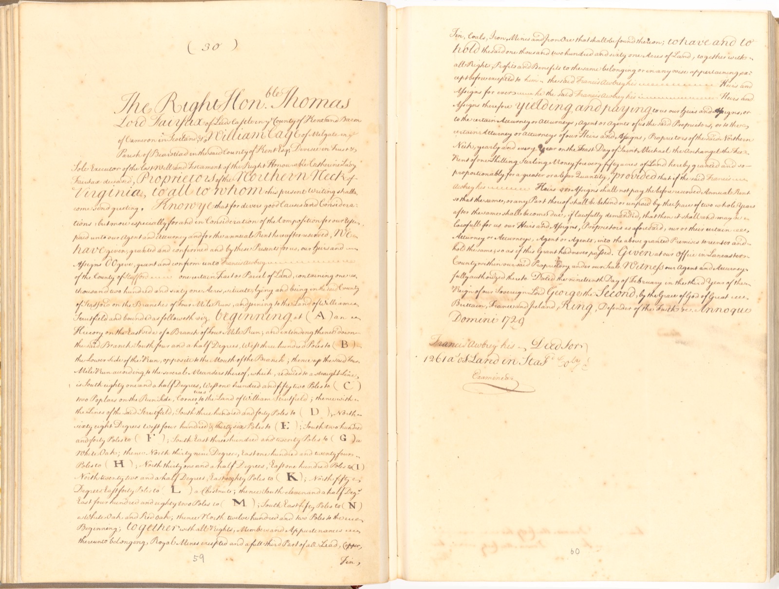
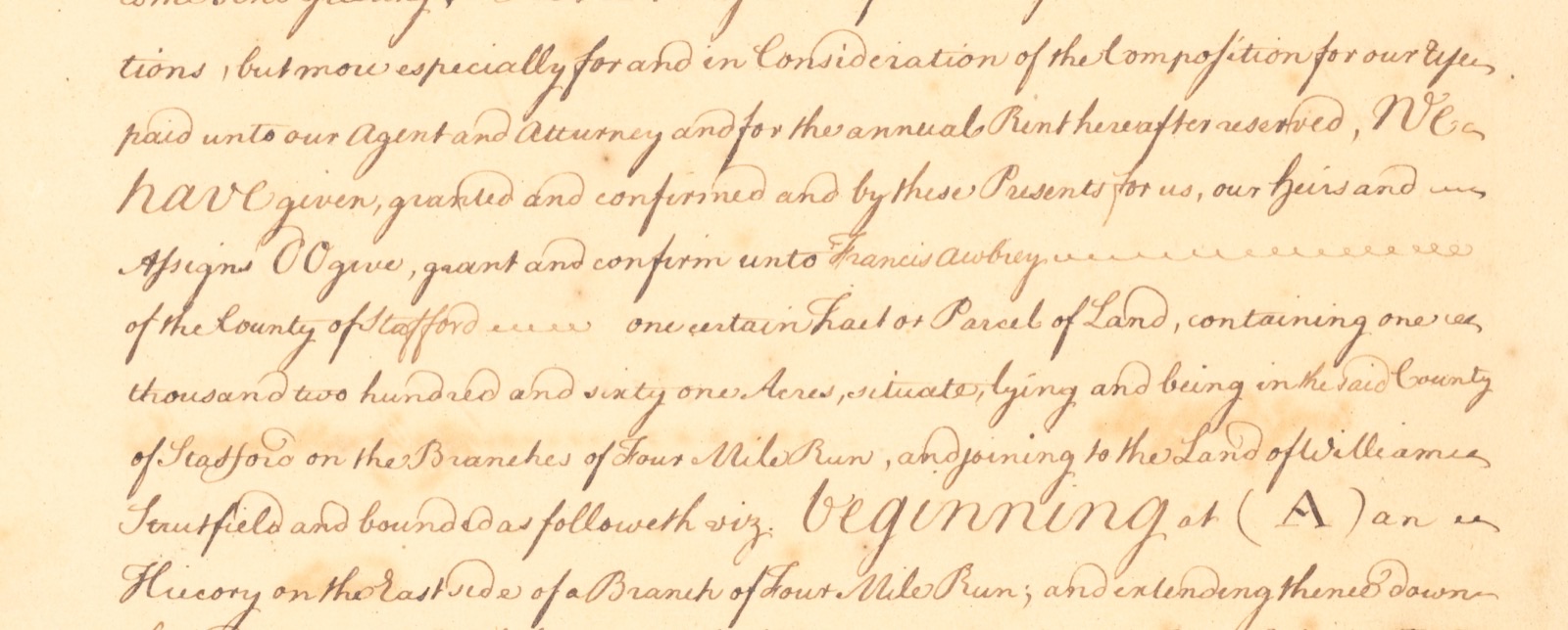
Next comes the man and the land. "We have given, granted and confirmed ... unto Francis Awbrey of the County of Stafford one certain tract or parcel of land, containing one thousand two hundred and sixty one acres," lying "on the branches of Four Mile Run, and joining to the land of William Strutfield." Read that last phrase twice. Grants often name neighbors, and a neighbor's name is a key to the next record.
Then the survey, the part most people skip and the part worth slowing down for. It is written in metes and bounds: a starting point, then a compass bearing and a distance to each corner, all the way around. "Beginning at (A) an hiccory on the east side of a branch of Four Mile Run," the line runs "South four and a half degrees, West three hundred poles to (B)," then follows the run "according to the several meanders thereof" to (C), "two poplars on the run side, corner trees to the land of William Strutfield." From there it follows Strutfield's lines and passes a white oak, a chestnut, and finally "a white oak and red oak" at (N), before running "North twelve hundred and two poles to the beginning."
A pole is the same as a rod: 16.5 feet. So 300 poles is just under a mile, and that last line of 1,202 poles is about three and three-quarter miles. Surveyors measured with a Gunter's chain of 66 feet, which is four poles, then converted. Notice also that the corners go A, B, C ... H, I, K, L, M, N. There is no J. In the eighteenth century I and J were still treated as one letter, so a missing J is normal, not a lost corner. With a protractor and the calls in order, you can draw this tract on paper and lay it beside the neighbors' grants.
After the boundaries come the strings attached. The proprietors kept "royal mines" and "a full third part of all lead, copper, tin, coals, iron mines and iron ore." And Francis and his heirs were to pay, "yearly and every year on the Feast Day of Saint Michael the Archangel," a rent "of one shilling sterling money for every fifty acres." For 1,261 acres that comes to about 25 shillings a year, due at Michaelmas, September 29. Miss two years and the proprietors could re-enter "as if this grant had never passed." This yearly charge is the quit rent, and it is why grants like this one sometimes get reissued to someone else.
Last, the date: "the nineteenth day of February in the third year of the reign of our Sovereign Lord George the Second ... Annoque Domini 1729." Two clues have to be read together. George II became king in June 1727, so his third regnal year ran from June 1729 to June 1730. And until 1752 the English year began on March 25, Lady Day. So a February date written "1729" falls in what we would call 1730, because the clerk's new year had not yet arrived. Genealogists write it 19 Feb. 1729/30. Below the grant the clerk added a docket for filing: "Francis Awbrey his Deed for 1261 a[cre]s of Land in Staff[ord] Co[unty]," and the word "Examined."
Now follow the neighbor. A 1986 article by Dorothea E. Abbott in the Arlington Historical Magazine traces William Struttfield's own 500-acre grant of 1709, the land where the Clarendon neighborhood of Arlington later grew. Citing Prince William County Deed Book B, she reports that in 1733 Anthony Carpenter, son of Struttfield's only daughter and heir, sold that land to Francis Awbrey of Prince William County for fifty pounds sterling. Did Francis move? Not necessarily. The same article lists the county changes: this ground was Stafford until 1731, then Prince William, then Fairfax from 1742. The land stayed put; the county line moved around it.
![Handwritten end of the grant: Given at our office in Lancaster County ... Dated the nineteenth day of February in the third year of the reign of our Sovereign Lord George the Second ... Annoque Domini 1729, with a docket below: Francis Awbrey his Deed for 1261 a[cre]s of Land in Staff[ord] Co[unty], Examined](/media/stories/the-hickory-on-four-mile-run/img-3.jpg)
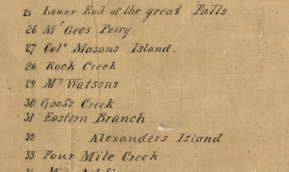
In 1738 the Virginia Assembly named a public ferry, in a law printed in Hening's Statutes at Large (volume 5, page 66): "on Potowmack river, from the plantation of Francis Awbrey, in the county of Prince William, over to Maryland," seven pence half penny for a man and the same for a horse. Abbott places that ferry on the old Struttfield land, opposite today's Theodore Roosevelt Island, running to the mouth of Rock Creek, with an ordinary, or licensed tavern, beside it.
Here the records start to disagree, and that is worth knowing. The law itself only says "the plantation of Francis Awbrey," and he had more than one. A 2005 National Park Service study of the upper Potomac says Awbrey owned more than 6,000 acres. It finds his home, marked "Capt. Awbreys," far upriver near Harrison Island on Robert Brooke's 1737 survey map, notes that his 1741 will mentions a ferry and an ordinary, and warns that the early ferry history along that stretch is confusing, with different sources giving different details. The Wikipedia article on Ellanor C. Lawrence Park, near Chantilly in western Fairfax County, lists in its timeline a 1727 grant to Awbrey of land south of Rocky Run there. Same man, many tracts, and you need the grant for each one.
Abbott's article carries the Four Mile Run neighborhood forward. She gives Francis's dates as 1690 to 1741 and reports that his will divided the Struttfield 500 acres between two of his seven sons, Richard and John, with Richard getting the 50 acres where the ferry and ordinary stood. Richard died first and left his part to John. John's will of 1743 named Hannover, described as his wife's daughter, and in the end the land was divided between Hannover and Frances Awbrey. In November 1767 the two women and their husbands, Owen Bradie and Philip Ellis, sold it to George Mason. She also found a 1744 Northern Neck grant of the same 50-acre ferry tract to a surveyor, Daniel Jennings, as "waste" land, "probably in error." Two grants, one piece of ground: a reminder that a grant shows what the office recorded, not always what was happening on the land.
One hickory tree, a neighbor's name, a rent day and a split year. Read slowly, a colonial grant hands you a map, a calendar and the next three records to find.
- In the Northern Neck of Virginia (between the Potomac and Rappahannock), look for land in the Northern Neck Grants books, not the colony's ordinary land patents.
- Write down every neighbor named in a grant or deed. The neighbor's land is often the next thing your ancestor bought, sold or inherited.
- Read the survey calls slowly: a pole or rod is 16.5 feet, and a plotted tract can be matched to the grants around it. A missing J in the corner letters is normal.
- Before 1752, any date from January 1 to March 24 may need double dating, as in 19 Feb. 1729/30. A regnal year helps you check which year the clerk meant.
- When a man is "of Stafford" one year and "of Prince William" the next, check county formation dates before assuming he moved.
- 1729 Northern Neck Grants C p30-31 Awbrey Grant 1261acres LVA (Wikimedia Commons, from the Library of Virginia)
- Dorothea E. Abbott, "The Roots of Clarendon," Arlington Historical Magazine, vol. 8, no. 2 (October 1986), pp. 46-54
- Hening, The Statutes at Large of Virginia, vol. 5, p. 66, An Act for appointing several new Ferries (Internet Archive)
- Fiedel, Bedell and LeeDecker, Cohongorooto: The Potomac Above the Falls (National Park Service, 2005)
- Ellanor C. Lawrence Park (Wikipedia, property timeline)
- A plan of Patomack River, from the mouth of Sherrendo, down to Chapawamsick, 1737 (Library of Congress)
How to cite this page
Daily Ancestor. "The Hickory on Four Mile Run." Stories from the Records. https://dailyancestor.com/stories/the-hickory-on-four-mile-run. Last checked 2026-10-01.